Guest Post – from Pete Rivera with Dave Cortez, Vanessa Ramos, Max Anderson and Al Braden
The Springdale-Airport Neighborhood Association (SANA) and the Sierra Club’s Environmental Justice Team (ATXEJ) invite you to hike and learn about Red Bluff in East Austin. We’ll begin at the intersection of Jain Lane & Stuart Circle by the Walnut Creek Hike & Bike Trail at 9am, Saturday April 9th. To get there, take Shady Lane east of Airport Blvd. It turns into Custer Rd and then into Jain Lane. We expect to arrive up on top of Red Bluff – located south of dead end on Harold Court at 11am.

The hike will be one way. Plan to return by the same route – or plan ahead and shuttle to Harold Court just off Highway 183. Wear pants, long-sleeved shirts and boots/shoes that you don’t mind getting wet.

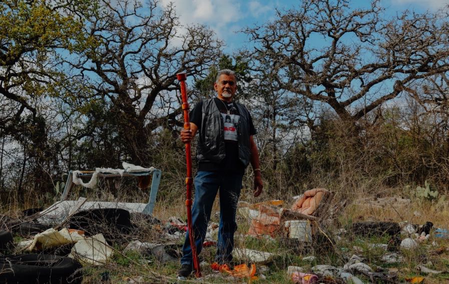
Referred to as “East Austin’s Mt. Bonnell” – for more than 50 years, the Red Bluff area has been neglected and used to dump chemicals, trash and oil. The City of Austin’s Watershed Protection Division owns it and it’s time to push the city to actually protect and restore it as a beautiful park in East Austin.


Join us to hike and hear directly from longtime residents of the neighborhood about their relationship with this land. Learn from community activists and organizers about the history of environmental racism and injustice in East Austin.

At La Loma Trail we will walk north though the East Boggy Creek Greenbelt up to the Capital Metro R.R.Tracks. Then we’ll head east on the south side of the tracks, up to Fort Branch Creek. Next we will walk north under the railroad bridge. There, we will cross the creek to the east and then head north uphill to the edge of the Red Bluff.
We’ll enjoy the beauty of the trees, creeks, hills and trails in the East Boggy Creek Greenbelt and also show the trail Eastside Memorial High School students have used to get to school for over 50 years – crossing back and forth over the “tracks” to school each day. Sometimes students have had to jump over or crawl under the railroad cars.
As we walk east along the tracks, we’ll see the site for Austin Energy’s new community solar facility. We’ll bring attention to the high cost to subscribe to solar energy from this facility – $25 more per month than what we pay now.
We’ll cross Fort Branch Creek and then hike up the hill to the top of Red Bluff. Here folks will witness for themselves the panoramic view of downtown Austin.
As we walk north on the Red Bluff trail we’ll witness the dumping that has been occurring for over 50 years. It’s never been clean. The hike will end at Harold Court off of Highway 183.


This hike is open to all and will serve as a space for education and community organizing.
Local filmmakers will also be on hand to document the hike and capture your impressions. Long term, we are confident we can get the city to clean up La Loma, but we aim to build a campaign that is centered on building power and supporting the residents in the Springdale-Airport neighborhood. One of the goals of the neighborhood is to turn the site into a nature preserve.
As this property belongs to the COA Watershed Protection Dept., we recently reported this to District 3 Councilman Pio Renteria’s office. We hope to get positive feedback and support from those that participate on our hike.
